Destinations are grouped in five categories: close to town, along I-44, South of Rolla, North and West of Rolla, South-East of Rolla. Within each group, destinations are sorted by distance from Rolla.
Close to town
| Destination | Location | Trails | |
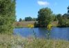
| Audobon Nature Center | in town across I-44 from campus Directions |
Audubon Society preserve short trails, totaling 3 miles |
 |
| Marguerite Bray Conservation Area | just outside of town off Bridge School Rd Directions |
2.5 mile loop trail several short loops |
 |
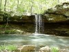
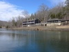
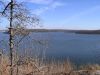
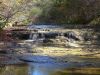
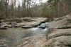
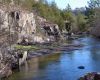
| Lane Springs Recreation Area | 11 miles South of Rolla off Hwy 63 Directions |
River+Spring Blossom Rock Trail 1 mi Cedar Bluff Trail 1mi Great for kids |
 |
| Maramec Spring | 16 miles from Rolla near St. James Directions |
Spring, fish hatchery, fishing several short trails Great for kids |
 |
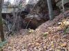
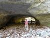
| Mill Creek Recreation Area | 14 miles from Rolla near Newburg Directions |
Kaintuck trail system 16 miles total
short loops of different lengths Natural tunnel |
 |
| Spring Creek Gap Conservation Area | 16 miles North of Rolla off Hwy 63 Directions |
Trail system and off trail hiking creek, rock formations |
 |
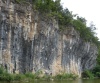
| Clifty Creek Natural Area |
33 miles from Rolla near Dixon Directions |
40 ft long natural bridge loop trail 2.5 mi |
 |
Along I-44
| Destination | Location | Trails | |
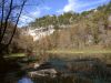
| Onondaga Cave SP | 36 miles from Rolla I-44 to Leasburg Directions |
Blue Heron trail 1 mi Deer Run Trail 2.5 mi Oak Ridge trail 3 mi Cave Tours |
 |
| Meramec State Park | 45 miles from Rolla I-44 to Sullivan Directions |
Natural Wonders trail 1.3 miles
Wilderness loop trail 10 miles Wilderness trail short cut 6 miles Bluff View trail 1.5 mi Hamilton Hollow 4 mi Trail description |
 |
| Shaw Nature Reserve |
68 miles from Rolla near Grey Summit off I-44 Directions |
14 mile trail network Trails starting from 0.5 mile length Wheel chair accessible trails |
 |
| Don Robinson State Park New! |
76 miles from Rolla near Pacific Directions |
4 mile Sandstone Canyon trail 2.4 mi LaBarque Hills trail |
 |
South of Rolla
| Destination | Location | Trails | |
| Paddy Creek Wilderness | 50 miles South of Rolla Hwy 63 to Licking Directions |
Big Piney Loop Trail 17 miles
South and North Loop 8-9 mi each Paddy Creek trail 0.85 mi |
 |
| Devil's Well | 50 miles South of Rolla off Hwy 19 Directions |
trail to Cave Spring 4.6 mi round trip | 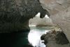 |
| Current River State Park |
54 miles South of Rolla off Hwy 19 Directions |
historic resort, several trails.
Current River Trail 5.25 mi to Echo Bluff SP |
 |
| Echo Bluff State Park | 55 miles South of Rolla off Hwy 19 Directions |
lodge, cabins, playground.
Painters Ridge trail 2 mi Current River Trail 5.25 mi to Current River SP |
 |
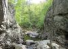
| Prairie Hollow Gorge | 78 mi from Rolla near Eminence Directions |
Rocky gorge, 100 ft high cliffs hike in stream bed 1/3 mi to gorge overlook |
 |
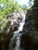
| Rocky Falls | 84 mi from Rolla near Eminence Directions |
3 mi to Klepzig Mill (one way)
3 mi to Stegall Mountain (one way) |
 |
| Alley Spring | 80 miles from Rolla near Eminence Directions |
Historic Mill 1.5 mile overlook loop trail |
 |
| Hercules Glades Wilderness | 140 miles from Rolla near Branson Directions |
30 miles of trails |  |
North and West of Rolla
| Destination | Location | Trails | |
| Painted Rock Conservation Area | 55 miles North of Rolla Hwy 63 to Westphalia Directions |
1.6 mile trail loop to overlook |  |
| Bennett Springs State Park | 69 miles from Rolla near Lebanon off I-44 Directions |
Natural Tunnel Trail 7 mi |  |
| Lake of the Ozarks State Park |
67 miles from Rolla near Osage Beach Directions |
35 miles of trails, Ozark Caverns cave tours
Rocky Top Trail 2 mi Honeyrun Trail 12.5 mi Trail of the Four Winds. 13 mi |
 |
| Ha Ha Tonka State Park | 74 miles from Rolla near Camdenton Directions |
Castle ruin, spring, natural arch
several short trails Devil's Kitchen Trail 1 mi one way Turkey Pen Hollow trail 7 mi |
 |
| Rock Bridge Memorial State Park |
89 miles North of Rolla near Columbia Directions |
Natural tunnel, cave entrances several trails 0.5 to 4 miles Good for kids 8.5 mile trail network in Gans Creek Wild Area |
 |
South-East of Rolla
| Destination | Location | Trails | |
| Bell Mountain Wilderness | 73 miles from Rolla near Black Directions |
12 mile loop trail | 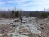 |
| Washington State Park |
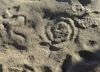
74 miles from Rolla near Potosi Directions |
1000 Steps Trail 1.5 mi Rockywood Trail 6 mi Petroglyphs |
 |
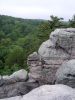
| Hughes Mountain Natural Area | 81 miles from Rolla near Irondale Directions |
Rhyolite formations Trail to top and back 1.5 mi |
 |
| Johnson Shutins State Park | 82 miles from Rolla near Centerville Directions |
Shut-Ins trail 2.5 mi
Horseshoe Glade trail 2 mi Goggins Mountain trail 10 mi |
 |
| Elephant Rocks State Park | 85 miles from Rolla near Belleview Directions |
Braille trail 1 mi | 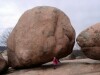 |
| St. Francois State Park |
89 miles from Rolla near Bonne Terre Directions |
Mooners Hollow Trail 3 mi
Swimming Deer Trail 3 mi |
 |
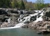
| Taum Sauk Mountain State Park | 100 miles from Rolla near Arcadia Directions |
Mina Sauk Falls - highest waterfall in MO
Mina Sauk Trail 3.5 mi Mina Sauk+ Ozark Trail to Devil's Tollgate 5 mi |
 |
| Pickle Springs Natural Area | 100 miles from Rolla near Farmington Directions |
Sandstone formations Trail Through Time 2 mi Great for kids! |
 |
| Hawn State Park | 104 miles from Rolla near Farmington Directions |
One of the best hikes in MO: Whispering Pines Trail 10 mi North Loup 6 mi / South Loop 4mi Pickle Creek trail 0.7 mi |
 |
| Millstream Gardens CA | 101 miles from Rolla near Ironton Directions |
Tiemal Shutins Trail 1 mile, disabled accessible
Trail to Silvermines Recreation area 4 mi | 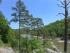 |
| Sam A. Baker State Park | 117 miles from Rolla near Patterson Directions |
Shut-ins Trail 3 mi
Mudlick Trail system 12 miles |
 |
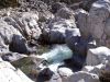
| Cathedral Canyon of Lower Rock Creek |
112 miles from Rolla near Arcadia Directions |
Shutins of Lower Rock Creek
remote and scenic, almost alpine atmosphere 4 mi round trip (2 mi off-trail in stream bed) |
 |
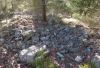
| Rockpile Mountain | 123 miles from Rolla near Fredericktown Directions |
7 mi round trip to summit
ancient stone circle of undetermined origin |
 |